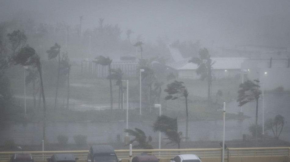
'Major' damage as Super Typhoon Bavi hits US island of Rota / Photo: Yuichi YAMAZAKI - AFP
A "super typhoon" with equivalent force to a category-five hurricane tore through the US island of Rota in the Pacific on Monday, with authorities saying they had received reports of "major" damage.
The National Weather Service (NWS) said the western eyewall of Super Typhoon Bavi was "currently moving over the island of Rota" and forecast winds of 180 miles per hour (290 kilometers per hour).
It urged residents on X to "treat these imminent extreme winds as if a tornado was approaching and move immediately to an interior room or shelter NOW!"
Local authorities on the small island -– the southernmost part of the Northern Marianas -- said they had already received reports from some of its roughly 1,500 inhabitants of "major damages".
"We are hanging in there. We are experiencing heavy winds and flooding here... Some people already reporting major damages," the Rota Municipal Operations Center's public information officer Lou Rosario said.
Rosario added that some cellphone services were down because of a fallen tower.
NWS meteorologist Landon Aydlett told a briefing on Facebook Live that the entirety of Rota was within the eye of the storm with maximum winds of 180 mph recorded.
The island of Tinian, northern parts of Guam and the southern tip of Saipan experienced winds equivalent to a category-one hurricane, Aydlett said.
"Super Typhoon Bavi is leaving the area," he said.
"Gradually, conditions are going to be improving. That is great news for us. It's not going to be lingering around like Super Typhoon Sinlaku did... in April."
The Northern Marianas and the nearby separate US territory of Guam are collectively home to around 210,000 people.
Authorities on Guam had said the island could see eight to 12 inches (20 to 30 centimeters) of rain, resulting in potential flash flooding.
When Sinlaku hit the island group -- around 9,500 kilometres (6,000 miles) west of the mainland United States -- it caused widespread devastation, ripping off roofs, toppling trees and leaving tens of thousands without power.
In 2023, another massive storm, Mawar, the biggest in decades, did huge damage.
Previously, the NWS had warned that a direct hit on Rota would make most of the island "uninhabitable for weeks, perhaps longer."
"Many non-concrete, non-reinforced homes will be destroyed, with total roof failure and wall collapse," it said.
"Nearly all trees will be snapped or uprooted and power poles downed. Fallen trees and power poles will isolate residential areas. Power outages will last for weeks to possibly months."
- 'It hurts' -
Several hundred people were holed up at the Guam Plaza Hotel as the windows shook violently and heavy rain flew horizontally outside.
Around 70 percent of the guests were locals who had moved in while the storm passes.
After the April typhoon, the hotel bought an $800,000 backup generator to ensure that the power kept running.
"Our hotel is locally owned so we cater to our local customers and we are going to make sure they have a shelter here," general manager Sudipta Basu, 59, told AFP.
"Our generator is full and it should run for the next two to three days."
Already on Sunday afternoon, there were few cars on the roads in Guam or the Northern Marianas, with almost all stores closed, many of them with their windows boarded up.
Pinky Cubacub, 55, said she bought $500 worth of plywood at a lumber store for her eatery on Guam.
"I cannot afford to lose so many days. It hurts," she told AFP.
Call center employee Arabella Paulino, 48, said: "My girls were saying to me it's scary. But it will be okay."
"My house is concrete, so the worst that can happen is a window could blow in," she told AFP.
Japanese tourist Miku Sakurai, 25, was supposed to fly back to Tokyo with her friends but their flight was cancelled.
"We will stay in the hotel when the storm comes. I am scared," the office worker told AFP.
- El Nino -
The world's oceans experienced their hottest June on record and could set fresh highs in the months ahead, the European Union's Copernicus Marine Service said on Wednesday.
Warmer oceans help tropical storms to intensify and add more moisture, which can fall as heavy rain.
The World Meteorological Organization warned on Friday that El Nino, which typically occurs every two to seven years and lasts nine to 12 months, has already begun in the tropical Pacific and is likely to be strong.
The natural climate phenomenon warms surface temperatures in the central and eastern equatorial Pacific Ocean, bringing worldwide changes in winds, pressure and rainfall patterns.
D.Nader--CdE